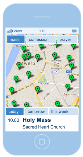
The basic idea is simple. There’s data about *where* stuff is. Google maps does a very good job of managing and displaying this sort of data. There’s also data about *when* stuff happens. Most of the time people not only want to find *where* some shop is located, but also *when* the shop is open. Or plain simple: is there a shop nearby that is open now?
Google maps is no good at finding this information: it is lacking a ‘time dimension’ in the information that it makes available.
This new web app (it doesn’t have a name yet, more on that later) will combine the power of looking up on a map *where* events are taking place and *when* events are scheduled.
Rather than having the data available in one big pool, like Google maps does, the app will have a separate account for each organization to publish events (I like to call them ‘spots’, because a spot can mean both time and place). Each account publishes its own instance of the app where users can find the spots for that account.
The ideal solution if your organization has multiple sites or if you organize events on different locations and you want to inform your customers or audience about where and when they can get to you.
There’s more, but that’s for a next post. This blog will keep track of the development of the app and for collecting your feedback.


